


Death of a Maverick
by Janice Pariza


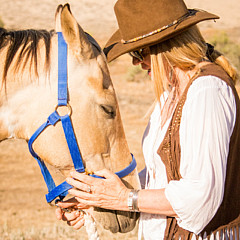
Title
Death of a Maverick
Artist
Janice Pariza
Medium
Photograph - Photography Art
Description
This old Maverick made a poor negotiation around a curve on The Million Dollar Highway on Colorado's Western Slope.
No matter what you want from a scenic drive, Colorado's famous Million Dollar Highway has it in spades. Loaded with sublime natural scenery, historically fascinating and visually appealing small towns, and, most of all, sheer driving pleasure, the Million Dollar Highway more than lives up to its name. One of the best-loved roads in the country, this classic stretch of two-lane blacktop forms a swirling ribbon through the San Juan Mountains, the wildest and ruggedest peaks in the Colorado Rockies. Marked on maps and by road signs as US-550, which runs south from the Gunnison River ranchlands around Montrose to the Southern Ute Indian Reservation, the Million Dollar tag is generally applied to the 25 steep and twisting miles that link Ouray and Silverton, a pair of remote gold and silver mining communities, but it's also an appropriate nickname for the entire 110 miles of US-550 that link US-50 with Ouray and Durango.
As you might expect of a road born in a Wild West mining country animated by tales of million-dollar fortunes earned, lost, and hoped-for, the history of the Million Dollar Highway is rife with legend. The route was first blazed by the so-called Pathfinder of the San Juans, a five-foot-tall Russian immigrant named Otto Mears who was working as a U.S. mail carrier between Silverton and Telluride. By 1882 Mears had created a lucrative toll road that he parlayed into a sizeable empire of roads and railroads, but his original hand-carved route through the mountains formed the basis of today's Million Dollar Highway.
Even the origin of the Million Dollar name is clouded in myth. Some say it was first used after an early traveler, complaining of the vertigo-inducing steepness of the route, said, I wouldn't go that way again if you paid me a million dollars. Others claim that it derives simply from the actual cost of paving the route in the 1930s. But the favorite explanation is also the most likely: When the highway was first constructed, the builders used gravel discarded by nearby gold and silver mines, only to find out later that this dirt was actually rich in ore and worth an estimated million dollars.
PURCHASE OPTIONS:
Prints of this art are available on canvas, metal, acrylic and gallery prints, framed or unframed, greeting cards and iPhone or Galaxy phone covers along with so many other quality items. FAA has a large selection of frames, mats and surfaces available for you to create museum quality masterpieces of your original print selections. Should you have any questions, feel free to contact me and I can give you any suggestions! Thank you!
IF YOU LIKE MY ART, I would be appreciative it if you would take a moment to favorite, like, tweet, pin to pinterest, google, stumbleupon and facebook . This enables my art and photography to be found on FAA and other internet searches.
I hope you enjoyed this visual journey! Please return often as I upload fresh work quite often! I am grateful for your time!
Uploaded
August 10th, 2014
Embed
Share


